Sunday, August 18, 2019

Beaver Islands Archipelago Exploration

THE DEPARTURE

We packed down the jet skis, in a Charlevoix boat lunch parking lot, in nearly 95* temperatures. As we looked at the bulk of gear that we had set out for the next week, I could not believe how much could fit onto these machines. We were about to go on an adventure.

It was Monday afternoon, July 15th, and we had gotten a little bit of a late start in Detroit, arriving at the Charlevoix Municipal Boat Ramp around 3pm. Luckily, we had skirted the storms that were passing through the area on the drive up, our major concern for the day. Our destination, the Beaver Island Archipelago, lay some 30+ miles off the coast. Slight winds out of the South West, were only but encouraging that we were in for a good time - after all, it was what we came for. The next few days were looking ripe windy, with SW 20-25kt days in the forcast. We packed nearly every kite we owned, an 8m, two 12m's, a 15m foil for the light days, and my 7m Wainman Gypsy, in case things got spicy. 

Jontan had built a "cargo rack" on the back of his Sea Doo, by mounting an ATV carrier, and welding posts to mount the kiteboards. It was a breeze. After we had begun loading some of the bulk items onto the vessels, two fellas in a white truck stopped by to inquire what we were up to. Maybe this was not a normal sighting? We told them that we were on a kiteboarding trip,  off to explore the potential of the Beaver Island Archipelago.  Apparently, we were some kind of attraction to them, with all of our mess lying about, soon to head out somewhere out of the common realm.

Packed up and ready to put in at the Charlevoix Municipal Boat Ramp. 
We parked the Jeep and trailer in the empty boat ramp parking lot, and headed on our way towards Round Lake, a small crossing taking in the sights of Charlevoix, before progressing through the drawbridge and into the channel towards the entrance to Lake Michigan.  

The afternoon had already undertaken us a few hours, but we were now moving, ever so slowly (3-5kts) through the No Wake zone. We had the two-way helmet communication system (BBtalkin) equipped, and could hear each other clearly. Jontan had been utilizing this system for the better part of a year now, and was a secondary safety measure, aside from sight and visual commands, in such a lake crossing. 
bbtalkin' in Round Lake on the route towards the drawbridge - Jontan puttering in the background. This is a no-wake zone. 
Last views of the entrance into Charlevoix, before we make our way into the Big Lake

With the storms that we had seen on the radar, it was difficult to be certain what we would encounter once we got to the open lake. Fog was a very real possibility, meaning that operating by sight alone was not going to be our first resort. Although the SeaDoo's did not come with a built in GPS system per-se, they did have a digital compass that we had calculated to be set to ~310* (NW) of our current point, the mouth of the channel in Charlevoix, towards the "mainland" of Beaver Island, and more specifically, the harbor of St. James.

Neither of us had been before, but this trip was a fantasy in the making for both of us, individually and collectively, since our early days of meeting each other, more than a decade prior. Kiteboarding, our mutual passion was what brought us together, and over the years, it served as the stimulus to exploration. We have circumnavigated the State on land, via overpacked sedan, Van and motorcycle in search of wind, and the unique spots that make the Great Lakes our sought-after Home. There were a few other spots on the list that we had still not checked off - along the Superior coast of Northern Ontario, and outer-lying islands, but by late-spring, we were drawn back to our native Emerald Isle and its freshwater sandy archipelago. This trip would not disappoint.

As luck would have it, even if we were to head due west, we would likely still encounter the fringes of this Lake Michigan oasis. We had both respectively fallen in love with two islands south of the Archipelago, in the Sleeping Bear Dunes National Lakeshore - The Manitou Islands - in our younger years. These islands, South and North Manitou, boast miles of sandy shorelines, desert-like plateaus, expansive forests, and massive 300ft perched dunes, characteristic of their mainland namesake.

With Beaver, and the surrounding islands, we did not know what to expect. We had studied Google maps satellite views for years, sending each other snapshots of what looked to be stray sandbars or sand-spits extending like underwater tendrils from wispy points along these smaller islands. [Insert some STATS about Beaver Island's size and the other islands around here] There ~13 smaller islands that comprise the Beaver Island Archipelago, stretching from the moderately sized South Fox Island to the far south (though arguably a separate archipelago) and the closer islands with names like Garden, Hog, High, Trout, Squaw, Whiskey, Hat and Shoe - some not in existence during high-water years, as we would come to find out.

Despite our passive worries that we would not make landfall with one of these sandy beasts, we were prepared and ready for the crossing, fog, rain, or as luck would have it, nearly dead still and sunny weather the whole way. As soon as we gunned it from the red beacon lighthouse guarding the harbor mouth, it was evident what these machines could do. Even with gear loaded down, we were at ~60miles/hr within seconds. The fun was contagious, and we raced away from the shore giddy, like we robbed the proverbial bank - and here we were, figuratively swimming in our loot. The jetski, dug in through the carves as we mixed between planing out speed runs and playful carves in the tepid summer butter that lay below us - perhaps a few hundred feet of it in parts. Although the shoals that lie between mainland Charlevoix, and the Islands are relatively shallower, we were still traversing in 150-300ft water. Some sections further south in the open water can reach closer to 900ft. It was hard to know exactly how deep of water we were in - but is there any difference between 150' or 300' when you are surrounded by this vastness. I had to find out.

After our play-time and exhilaration of embarking far enough from shore, we decided to pause our vessels, perhaps share in a beverage or two, and of course, I could not help going in for a dive. There is only so far you can reach on human power - a deep breath, a powerful lunge, and a few kicks might add a few feet, but of what significance when you cannot fathom any difference between the blue of 150 or 300 feet? Coming up, is the funnest part - in waters like these and on days like this, turning upwards, is like ascending to Heaven.


The water scatters the Sun's light, as if through a translucent turquoise jelly, in which you are temporarily suspended - giving that proverbial "light-at-the-end-of-tunnel" effect, as you begin to ascend back upwards, towards the surface of this freshwater aether. Unless, of course, you choose to take those few extra kicks, or a shorter breath on the down-stroke, in which case, it might actually be the former. It would be difficult to consult a physician in the middle of the Lake, but it's safe to say I did not risk it on this attempt, and the 150 -300ft window, remained open - with the view up much the same.
From there, we sipped the bottoms off our beers and poured the rest of the drips into the Lake, collecting some water from the rinse to take a sip - something that would normally remain unadvised, in any body of water, and especially midsummer, but how could I abstain after taking in such delights of its depths. 

The surface remained clear, much in the way an undulating mirror would bend in a lucid Dali designed landscape; a floating desert of water - mirage of blue, as far as the senses could see. How could I not indulge them all equally. It was silent, as we waded in the footwells of the vessels for our remaining belonging to be anchored back down. A series of ratchet straps and bungies held in place the hodgepodge of gear we attached to these strange ships - I wish we had brought more - maybe a wheeled vehicle like a longboard, to skate around, once we got into the harbor of St. James. Every well-stocked vessel needs a pair of wheeled vehicles, for the mainland - whether they be in-line, side-by-side, or in this case, the long-deck format. But alas, we had no clue what to expect from the geographical anomalies of this island mainland we were tasked to encounter - and so we brought all we thought we should.


THE ARRIVAL

We overshot the entrance to the harbor, perhaps intentionally?


Wednesday, March 2, 2016

Wild Little Winter...

From the first fall of snow in November to the fleeting glimpses of Winter's sun, it's been a nice and wild one!

Spending the last part of Winter break in Sleeping Bear Dunes got things officially to start, with the typical blanket of snow that's hard to find downstate. I drove up there on a whim due to my plans of going on a solot trip through Canada that were botched by a last-minute ice storm the day before I had planned to leave. 

Heading North, I spied maps of the northern Ontario coastline, but pulled off the highway, instead opting for the Western shore of the more familiar peninsula. I hit it big, getting to Platte River Campground around 9:30pm to a fresh 10inches of snow and an ambience of quiet that's hard to find 'till that latitude. I was alone, no other cars/campers around. Taking the proper time to let the stillness sit in, I set up camp (hammock) for the night and went for a solitary walk along the road, where the loudest noisees I heard were my breath and the swishing of snow beneath my boots. I walked to the end of the river mouth, where the Platte River meets the vast outpourings of Lake Michigan.

The next days were spent exploring. I snowkited for the first time of the year, right at the park at the mouth of the river. The wind was only looking to increase for the next couple of days and I decided to head farther North, spending the night in my car at Peterson, in favor of an early start for the day. 

It was New Year's eve day and the wind was right. A brief trial run of conditions turned into mind-blowing bliss and an entire day of exploring coastal foredunes layered in a base of popcorn kernel snow and sprinkled with a batter of powder served in succesively larger bowls. I couldn't get enough.

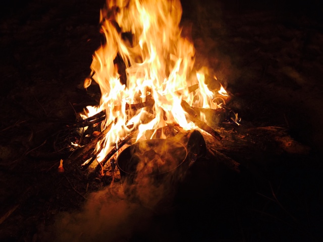
I ended up riding back upwind as much as the elements would take me (about half-way on a two mile joirney) and decided to camp out for the night. It was New Year's eve, and although Travere City was less than an hour away, the decision for the first time in my life was to spend it solo. I made a big fire, beans and pork sausage (Romanian tradition) for a meal and slept on my kite that night.

Sunday, November 22, 2015

Welcoming Winter in the Yurt

What a wonderful weekend to bring people together and welcome the Winter's first birth.

I had invited a small group of friends to join me this weekend at the Muskegon State Park "Yurt" to partake in a ritual that is near to my heart. I had put this date in the calendar months ago, but only on high hopes; little did I know that it would actually turn out to be a pretty terrific time.

First glimpses of wonder

JP-Lounging hard

Strike a pose/ while everyone was looking for my lost go-pro/ the journey continued.
A little guidance led to some unplanned symmetry

Monday, November 16, 2015

A Sunny November--To the Lakeshore

Woke up on this Sunday, Nov 15th, morning with no clear plans, rested and curious about what the free hours of the day could bring in terms of unfinished projects. I had finally repaired a front blinker light on the car that had been damaged since last winter and was eager to continue the momentum on other projects. A quick step outside the backdoor around 9:30 am revealed there would be no time for such ambitious ideas, it was way to amazing out to do anything utile at home. The air had a slight whiff of South breeze and my jonesin' bones knew that this is the most difficult time to make a decision.

I quickly threw all my kites in the car, a couple wetsuits, boiled some eggs, found a crumb of molded cheese, a piece of beef jerky, made some quick coffee, and had the brilliant idea to circumvent my actual plans with my hidden plans to take the bike for "one last ride" of the season. Packed the bike with a foil-kite and harness (✔️) and threw goodies (brewskies optional, though in reserve) and a jacket in for the long haul (~50miles) to the Lake, depending on the lack of a path chosen. And what a great choice that was.

Let me tell you, everything they tell you in movies about bikes and the open road is partially true and partially you, but they complement each other well. After brief initial conflicts whether to dedicate the whole day to such a trip, I put the pack on and began heading West. That was about the plan. Muskegon at some point. Fields in the middle; some open roads and scenic winds and bends slightly required (✔️). 

Dang. Like and endless meditation. Every breath, a new smell of a changing countryside, every bit as pungent as expected, though quickly changing to a new olfactory experience. The sunshine tasted beautiful. After a quick rendezvous with the service roads off the highway, spanning views of open fields, distinct Allendale smells, and this relentless Nov sun, my mood began to match my surroundings and the bike. I began to incorporate with the machine, matching our speed to our moods and the inspirations of the landscape. That was cool. I'm a newbie to all of this, but there's something thrilling and inherent in the experience that becomes clear to the rider who allows all sensation to become.

And that it did and the ride was glorious and intense and boring and diverse. A few rights north to tack some ground, a few lefts West to cut some angles and I found myself on unfamiliar and familiar roads of the M46 corridor. I like the unknowing part of the ride. After a brief spurt where I learned to fly (ET phone home?) I gave in to my sensations, as bewildering and deceiving as they were with wind playing by my ears and speed denying me trust in my perceptions; I became them. At that rate, what use is rationality; all must become instinct. I found an old familiar road, that by accident had become a summer occurrence on the way North to the Musk River. We had a camp spot off of there from the Spring and I had lots of deep memories ironically from this relatively 'new' area. I climbed the steep bends, trusting each curve as if I'd made it, then reminding myself that I didn't. Saw wide expanses of marsh, stopped for a stroll and continued West. 

Packed the Yamaha FZ09 - at the Muskegon Winter Sports Complex 
I arrived at the Lakeshore of Muskegon State Park roughly an hour & 1/2 later, with several scenic breaks. The waves were waving, though I walked the harbor and talked to ma for a while about the difficulties that life often finds us in. I reminded myself to remember that and enjoy this. 

Took a stroll to the the goods. Parked at the winter sports complex (after all, the scope of the trip was partially to check out the Yurt I had booked for the next weekend) and hiked around for a while, by the luge and upper hills, as I had done in this are many times before. Always a favorite. 

Small vernal pond at a low spot between the foredunes.
Snapped some pics of the Yurt and headed to the beach. Gorgeous. Set up the hammock, walked, dabbled, watched the sun set, shed some layers, dipped. Nov in Lake Michigan, who would have thought?


Thursday, June 25, 2015

Summer Solstice on South Manitou Isl.


South Manitou Island 

June 19-23, 2015

Looking North from the boathouse towards the docks.


View of the Francisco Morazan shipwreck, permanently docked on the island since 1960.

Top of the Dunes Trail; fog, heavy, rolling in like clouds over the tree line.

Early Summer ephemerals in full bloom. June 21st, on top of the dunes.


Tuesday, April 22, 2014

Algonquin Backcountry Snowkiting/ Camping Adventure

Spring Break! What does one do--fly to warmer places, right? Well, sort of....

This trip brought me back to my childhood heaven of Algonquin Provincial Park. Nestled in the center of Ontario, Canada's vast interconnected wilderness of lakes, Algonquin Park has always been an escape for me. In my teenage years, it formed the basis of most of my dreams. The summer that I spent working in the Park at Camp Tamakwa was one of the best I've ever had. Canoeing in the solitude of glassy, clear lakes, spending days basking on the massive granite rocks, fishing and wandering through the backcounrty was as much as any kid needed. But that was Summer. Winters in Algonquin can get a bit heavy, and this one in particular was no slouch. It dumped much snow on the area, and kept that piled high as temperatures in the 2013-2014 winter stayed consistently below freezing across most of the northern latitudes of the Midwest and Canada. In mid April, ice on the big lakes (away from the slush of shore) exceeded 1ft (+30cm)  and snow ranged from 1-2ft (60cm) in most parts of the forest that I traveled.

I spent 4 days in the backcountry, exploring the woods and lakes with the help of snowshoes, skis, a sled, my backpack(s) and a kite. My winter exploration took me from the start at Mew Lake campground, across the Lake of Two Rivers and down the old railway trail to the southern border of Whitefish Lake approaching Rock Lake. The weather was terrific, mostly sunny and 50's - 60's F during the day (~10*C) and down to mid 20's F at night (slightly below ~ 0*C).

Tuesday April 8th, Day 1: Getting started among some early morning snowfall @ Tea Lake near Hwy 60.


Camp for the first night, on the river following Pog Lake.

After a long day of backtracking (unintentional exploration), snowkiting across a frozen lake, and beating the rail-trail on snowshoes for a few hours, this slice of open area beside the river was a welcomed sight as the sun began to fade behind the forest ridges.


Day 2: My sled was repacked and ready to tow on the rail-trail after a friendly visit from a park ranger (the only person I saw in the backcountry, on duty at a nearby dam) telling me to "politely move" my campsite to a new location as it was not far enough away from the regulated distance from a body of water. We had a lengthy discussion about my situation the night before and plans for the day, but he insisted and was optimistic about potential sites farther along the route. This made for another day of hauling the sled and finding a new place to lay out for the night. The day was beautiful and warm, causing a lot of melting (and sled tipping) along lake shores and on open parts of the trail. I must have tipped the sled 5 times in a minute before I got fed up and dragged it by hand.


An old railway bridge crossing a marsh creek at the narrow, upper end of Whitefish Lake.
The trail, in most forest sections, was cool and well packed with snow. I walked through this scenery for a few hours before coming to the wide portion of Whitefish Lake, where I busted out the kite and skis and tried to cut down on the travel time on foot.

 It was not an easy day however, and the location of the old lumber mill that was recommended as a place to camp near Whitefish Lake was not to be found. This made for an uncomfortable evening of searching for a place to stay as the sun was nearing the horizon and into the late-twilight of the evening. I settled near a field of milkweed, "guided" by two moths that crossed my path in the warm, early-season dance for mates.

Day 3: Hard-going: no photos on camera.

Day 4: After the night at the Pow-Wow shelter.


Back to the Dam where I had camped the first night. This time the trek was a little easier, having already encountered this trail and knowing I had to be back at the car with some daylight left in the bag. I took a lunch of hard-boiled eggs, pork shoulder, salami and cheese that I had saved up for a hefty snack.